Ford Oaks Planning Boundary Main Site

The Site

The Proposed Development site stretches across c.74 hectares of the valley, 45 hectares of which will be utilised for planting and wildlife enhancements and around 29 hectares for the solar scheme.

The site is located c.6.5km east of Exeter, to the west and south of Marsh Green village, east of the A30. The nearest postcode is EX2 2EU (OS Grid Reference X303529, Y092960).

The site includes 29 field parcels which are currently used mainly for grazing with 2 fields used for crop production on rotation with pasture leys.

The fields all feature hedgerow boundaries interspersed with, mainly, oak and ash trees. Whilst we are expecting a minor widening of a handful of gateways, these will be reinstated following completion of the construction phase. All of these natural assets will be retained and protected.

The land is part of a shallow valley which falls from hills around Aylesbeare Common to the SE and continues west of the A30 towards Rockbeare, with a water course ‘Ford Stream’ passing through the valley in the middle of the site just north of Westcott Lane. The valley sides rise to the ridges north of Marsh Green and south at Withybed Lane.

There are no residential buildings within the development site red line boundary but there are two barns.

Large electricity pylons bisect the site from north to south, with other overhead line circuits passing east – west across the valley.

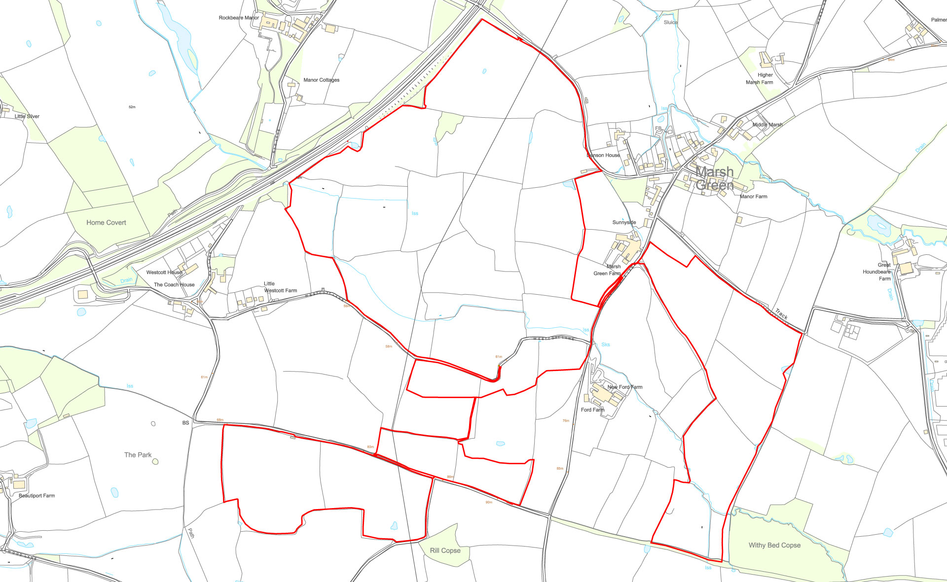
JBA Surface Water Flooding

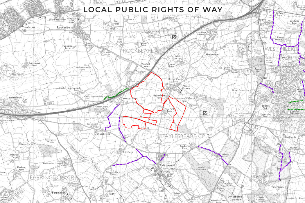
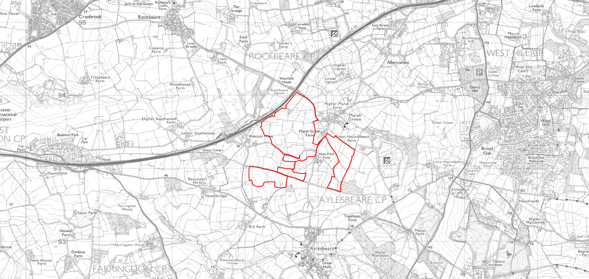
The site is mainly located in Flood Zone 1, indicating a low probability of flooding. Ford Stream bisects the site in the land parcels north of Wescott Lane. The area immediately surrounding the brook varies between Flood Zone 2 and 3 and will be enhanced as ecological and landscape planting.

local public rights of way
Local Public Rights of Way

The development does not intersect any Public Rights of Way, the Aylesbeare Footpath 7 runs parallel to the western boundary.

The Surrounding Area

The proposed development has been sensitively designed to ensure that it is not harmful to the surrounding area.

Some key geographical considerations have been taken into account when designing the proposals. These included the following:

  1. The A30 forms the northern and western boundary of the site.
  2. The nearest settlements to the site are the small hamlet of Westcott, located immediately to the west of the site and the village of Marsh Green which borders the site to the northeast.
  3. There are smaller pockets of houses around these villages.
  4. Aylesbeare is c.0.75km to the south of the site.
  5. To the east, the settlement edge of West Hill is c.2km from the site boundary beyond which is the larger settlements of Ottery St Mary c.6km from the site.
  6. c.3.9km to the west of the site is Exeter International Airport.
  7. Rockbeare Manor, a grade II listed building with a registered park and garden, is separated from the site by the A30, c.0.5km north of the development.
  8. The East Devon Area of Outstanding Natural Beauty (AONB) sits c.1.2km to the east of the development site.
  9. Immediately southeast of the site is the County Wildlife Sites of Withybed Copse.